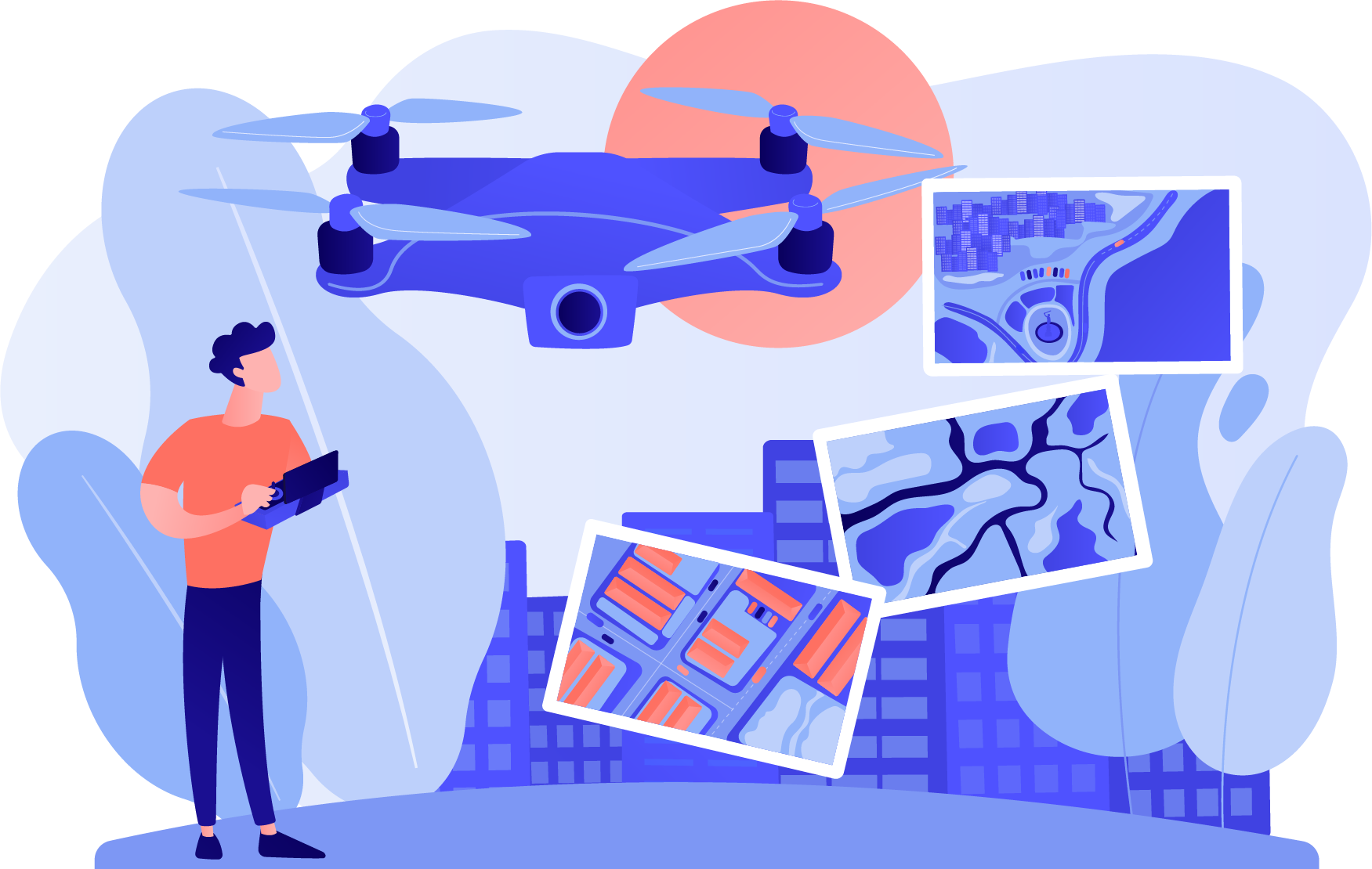
Professional Drone Services for Real Estate, Construction, and Telecom in Florida
Expert drone services for precise mapping, roof inspections, real estate videography, and telecom inspections.
Elevate your asset management with our efficient, high-resolution aerial solutions. Our comprehensive drone
services include:
Real Estate: Showcase properties from unique perspectives with our high-quality aerial
videography and photography, enhancing your real estate marketing.
Roof Inspection: Identify issues and maintain the integrity of your roofing systems with our
accurate and thorough drone inspections.
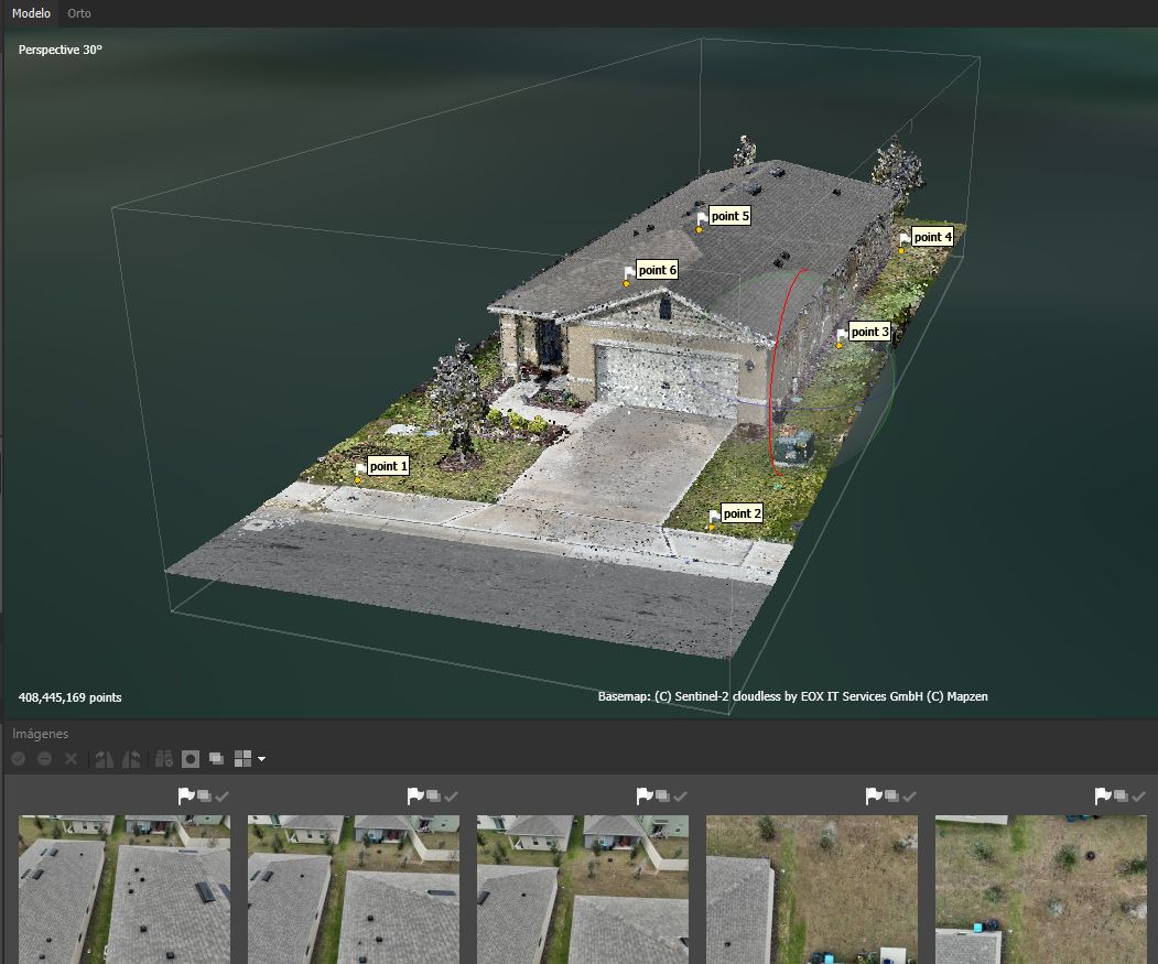
3D Mapping and Modeling: Achieve precise and detailed 3D models and maps for your projects,
utilizing advanced drone technology for superior accuracy.
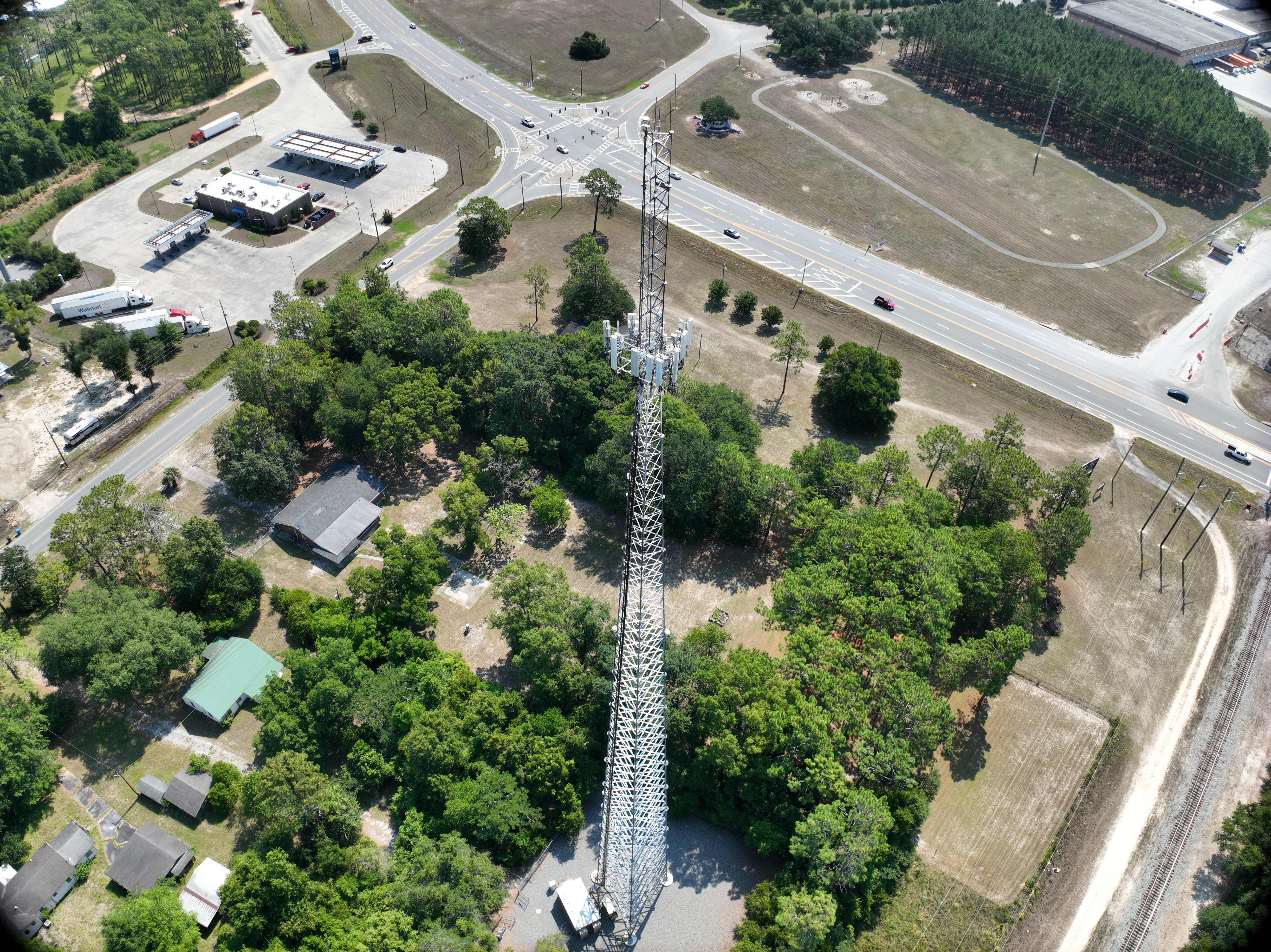
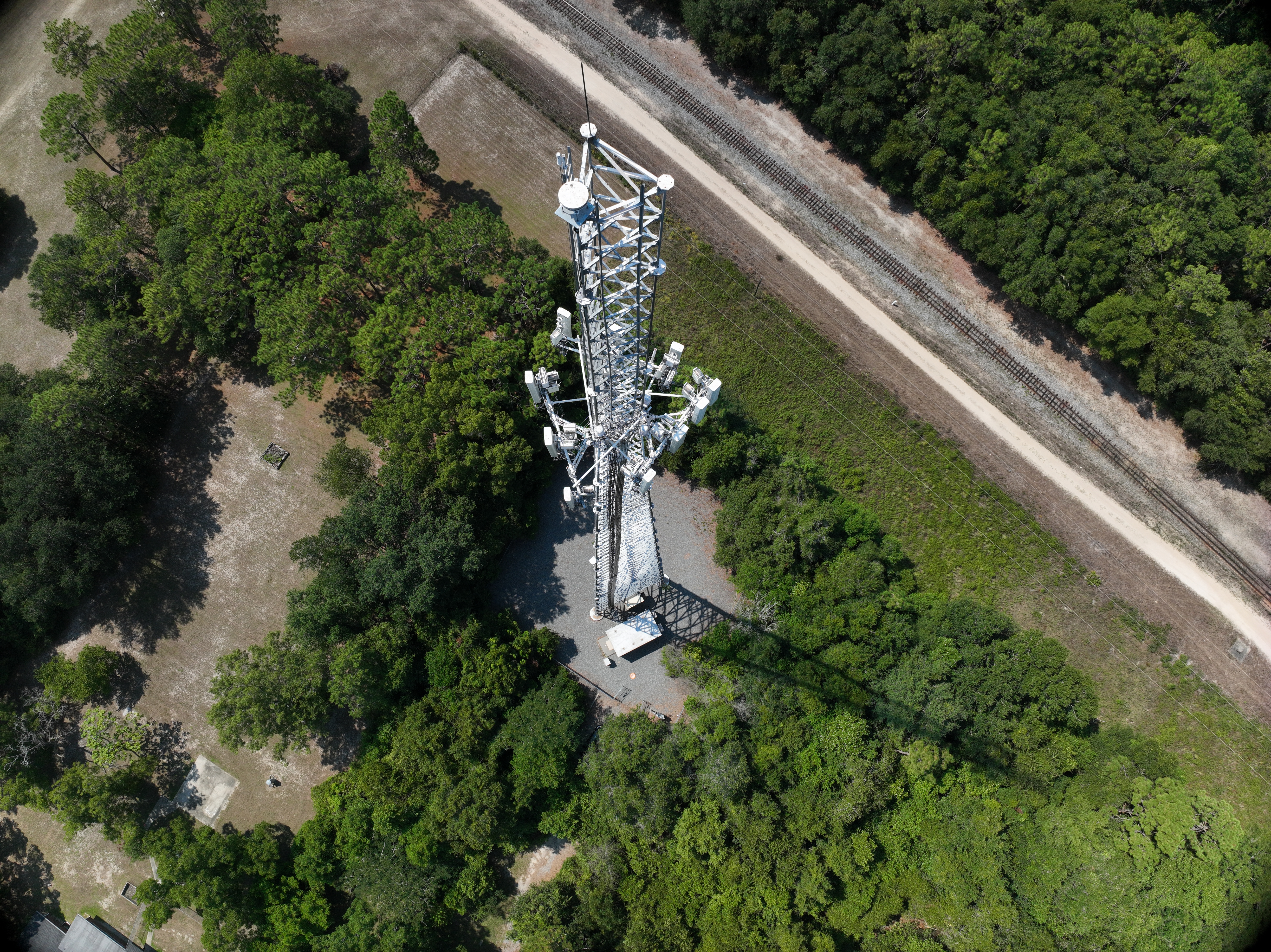
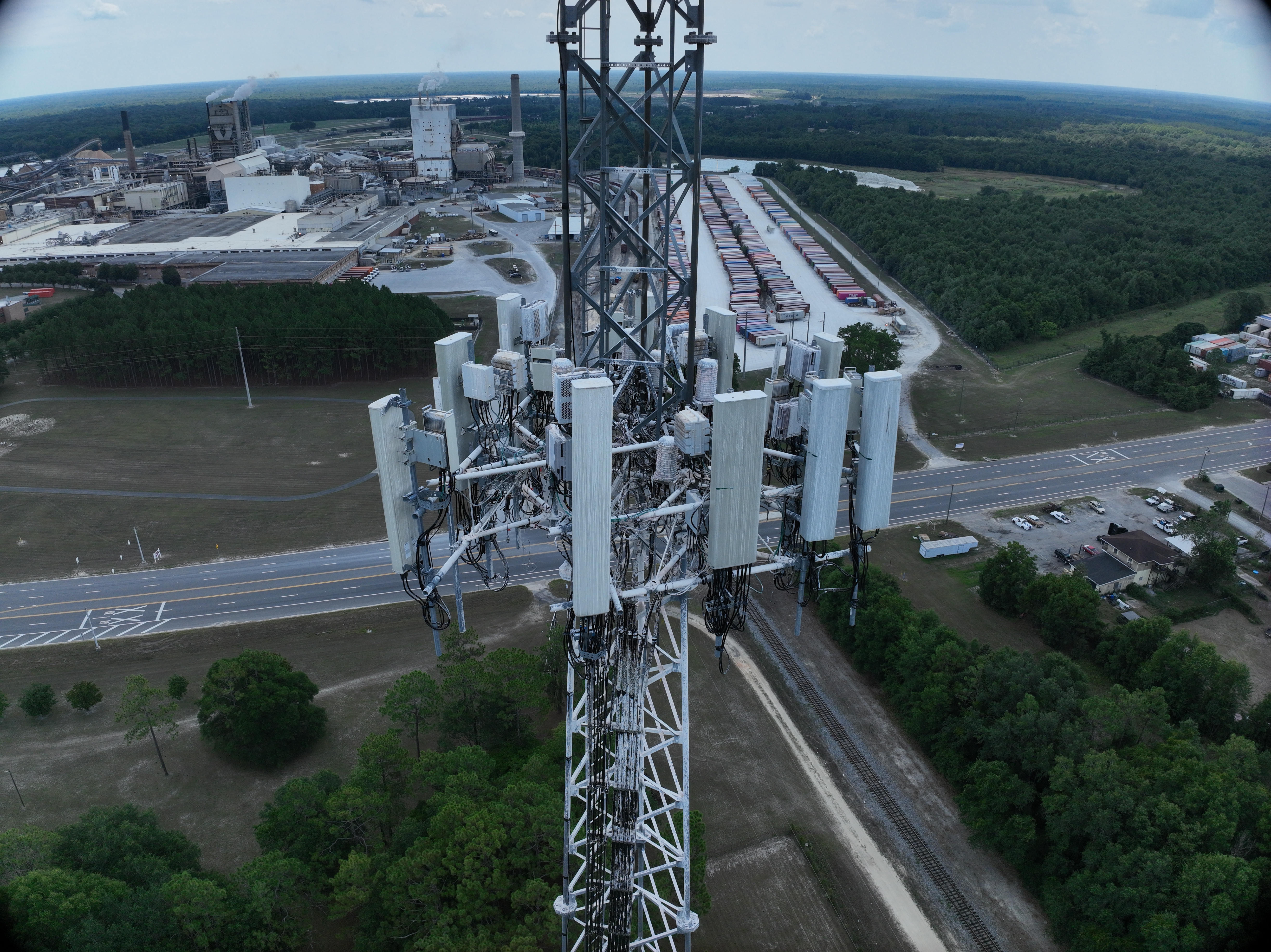
Telecom Inspection: Ensure the optimal performance and safety of your telecommunications
infrastructure with our detailed aerial inspections.
Discover how our cutting-edge drone solutions can transform your vision into reality. We're here to provide
guidance every step of the way.
10x
Accelerating Data Acquisition with Advanced Drone Technology
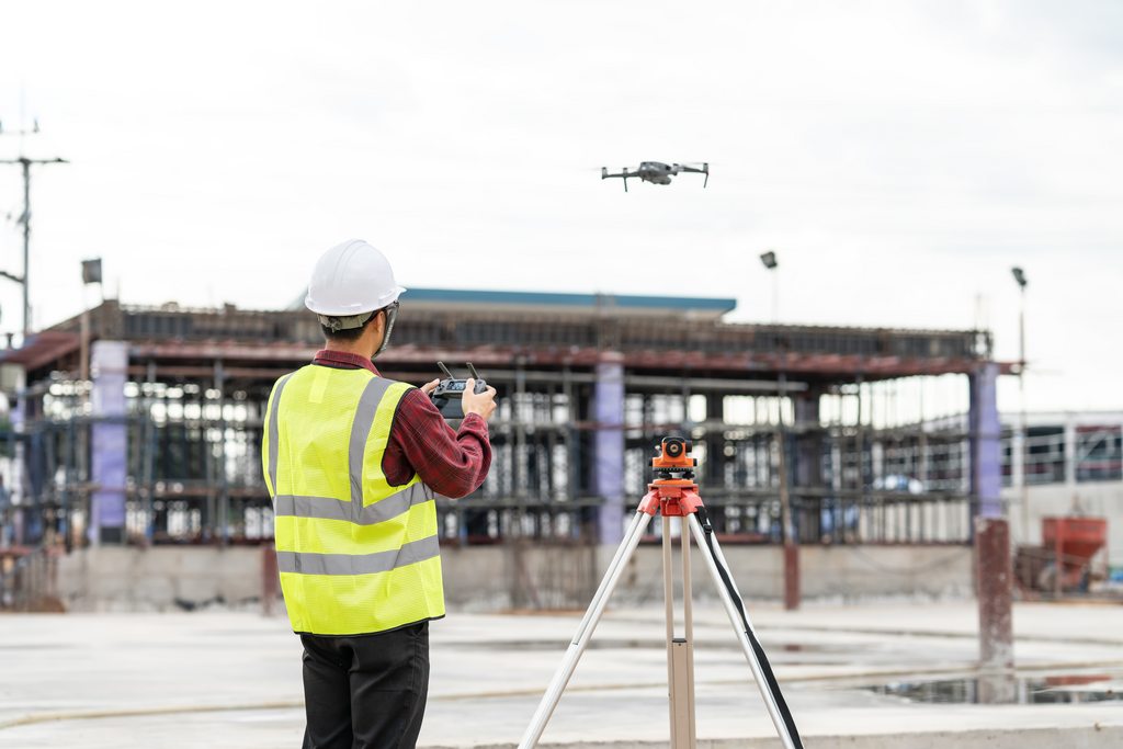
At DTA Solution, our team of certified drone pilots leverages state-of-the-art UAV technology for surveying and inspection tasks, enabling us to capture critical data up to 10 times faster than conventional methods. This rapid data acquisition not only streamlines project timelines but also significantly reduces downtime, offering our clients unparalleled efficiency and a competitive edge in their operations.
High Precision Surveys
Up to 99% Accuracy
At DTA Solution, we harness the power of machine learning alongside our comprehensive UAV surveying and mapping techniques to deliver volumetric measurements and yield estimations with up to 99% accuracy. This exceptional level of precision ensures reliable data for planning, analysis, and decision-making, significantly enhancing the value and efficiency of your projects.
Industry Leadership
Committed to Excellence
At DTA Solution, we've solidified our reputation in the industry through relentless dedication and outstanding performance. Our commitment to pushing the boundaries of innovation and enhancing service quality each day sets us apart. We are devoted to delivering unparalleled value to our clients, constantly refining our techniques and embracing cutting-edge technologies to meet and exceed the evolving demands of the market.
Our Services

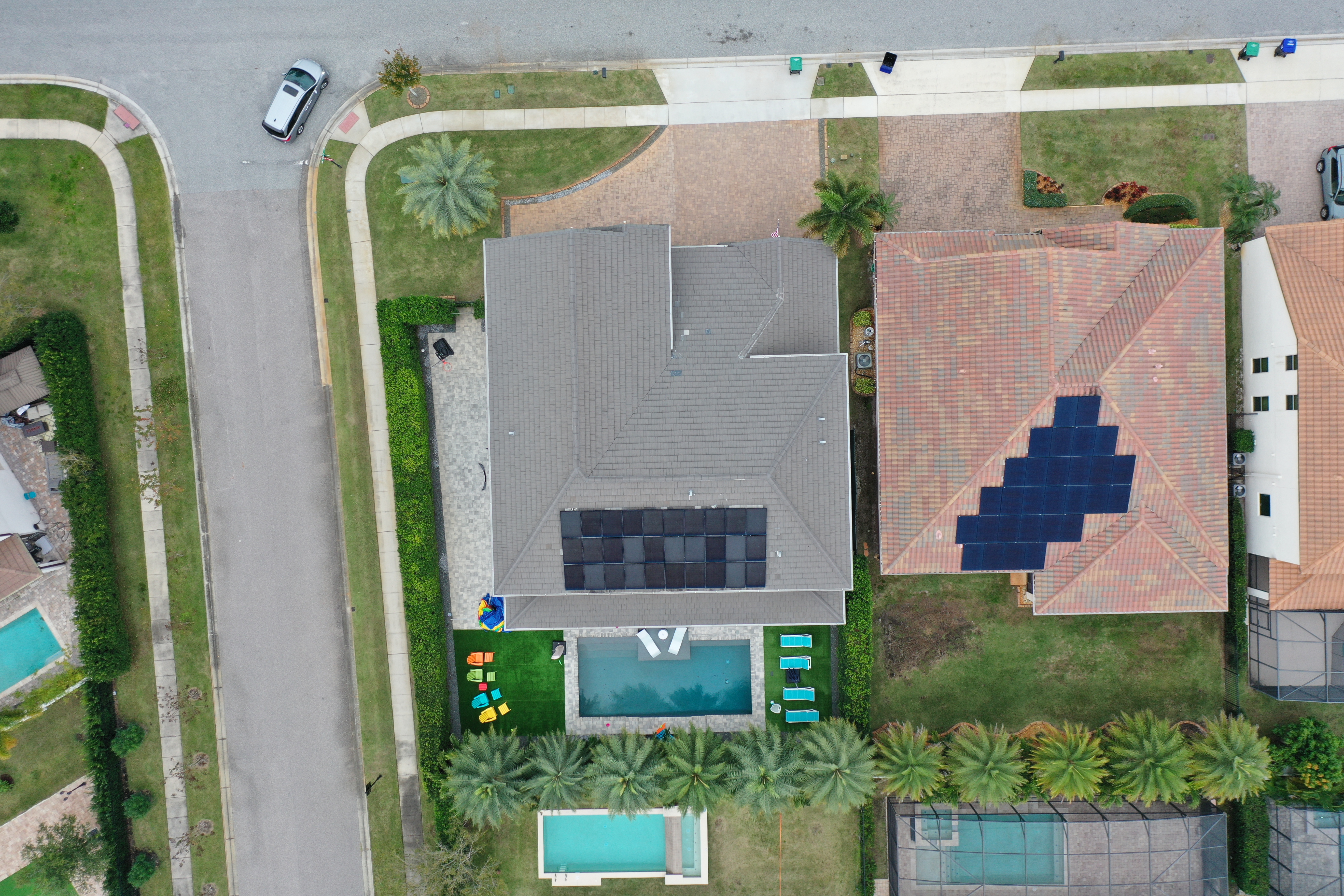
Real Estate
Showcase properties from unique perspectives with our high-quality aerial videography and photography. Enhance your real estate marketing with breathtaking visuals that capture the essence of properties, helping you attract more buyers and close deals faster.

Telecom Inspection
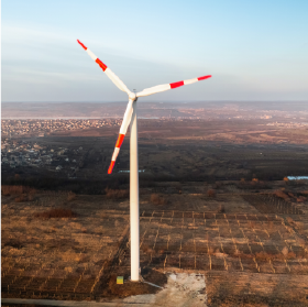
Ensure the optimal performance and safety of your telecommunications infrastructure with our detailed aerial inspections. Our expertise spans specialized inspections for towers, antennas, and other critical telecom assets. Leveraging state-of-the-art visual and thermal imaging technologies, we are committed to ensuring the durability and operational efficiency of your valuable telecom assets.

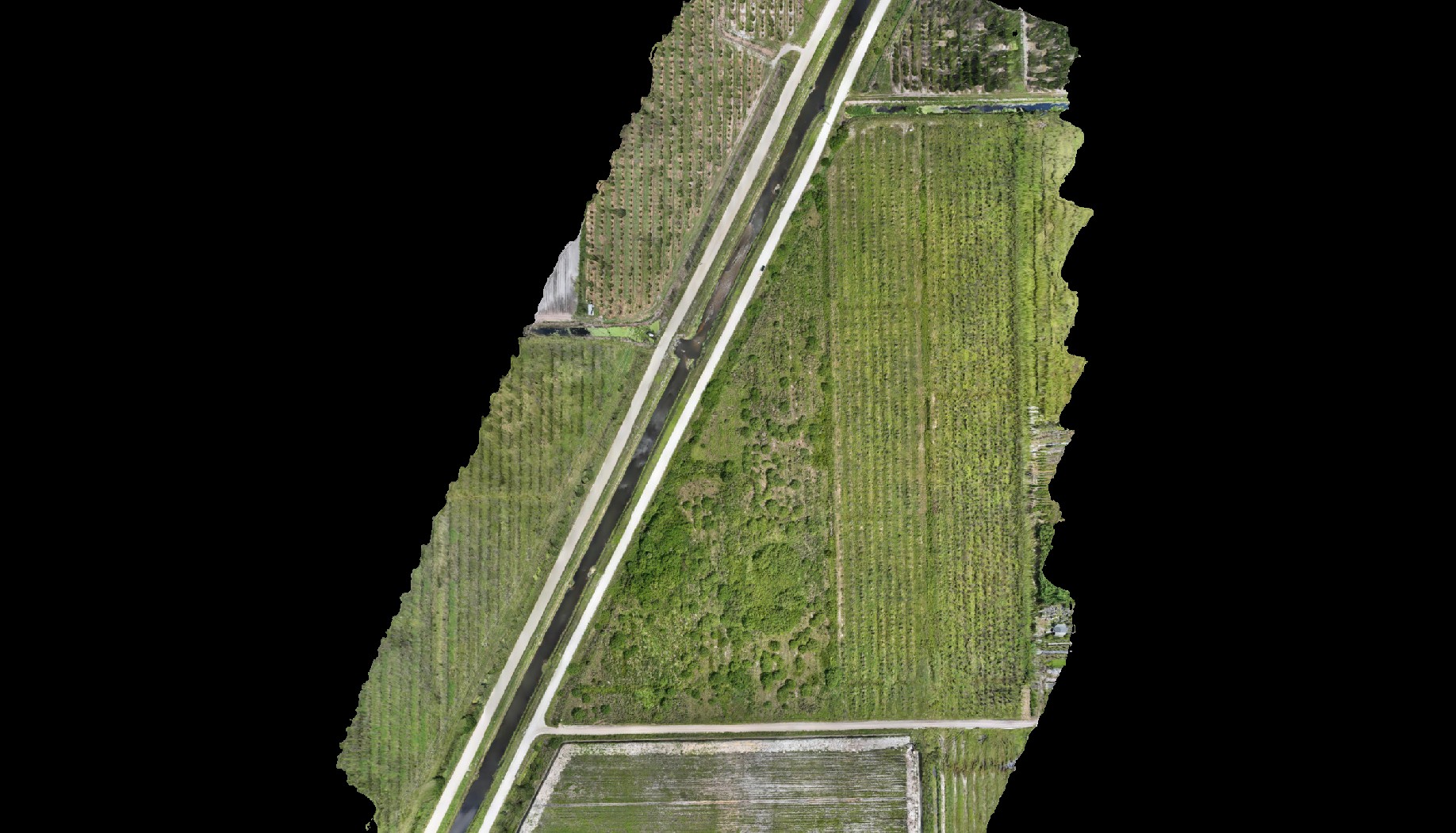
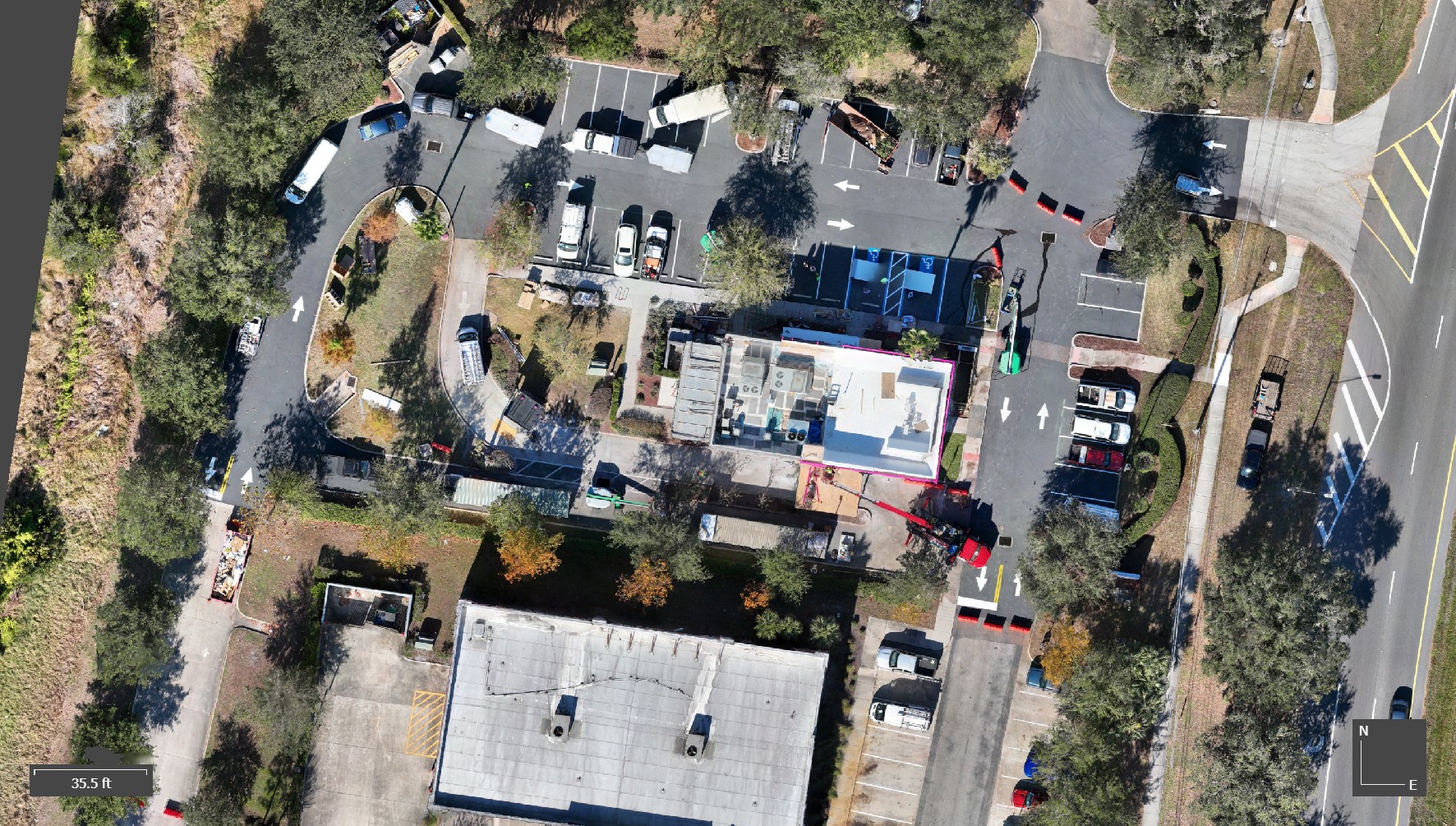
Surveying / Mapping
Our Surveying and Mapping Services are designed to meet the precise needs of engineering and construction projects. We specialize in delivering detailed AutoCAD Linework and advanced Drone Mapping solutions. Our offerings include the creation of Orthomosaic Maps, 3D Point Clouds, and highly accurate Digital Elevation Models (DEMs) and Digital Terrain Models (DTMs), ensuring comprehensive analyses and insights for your projects.

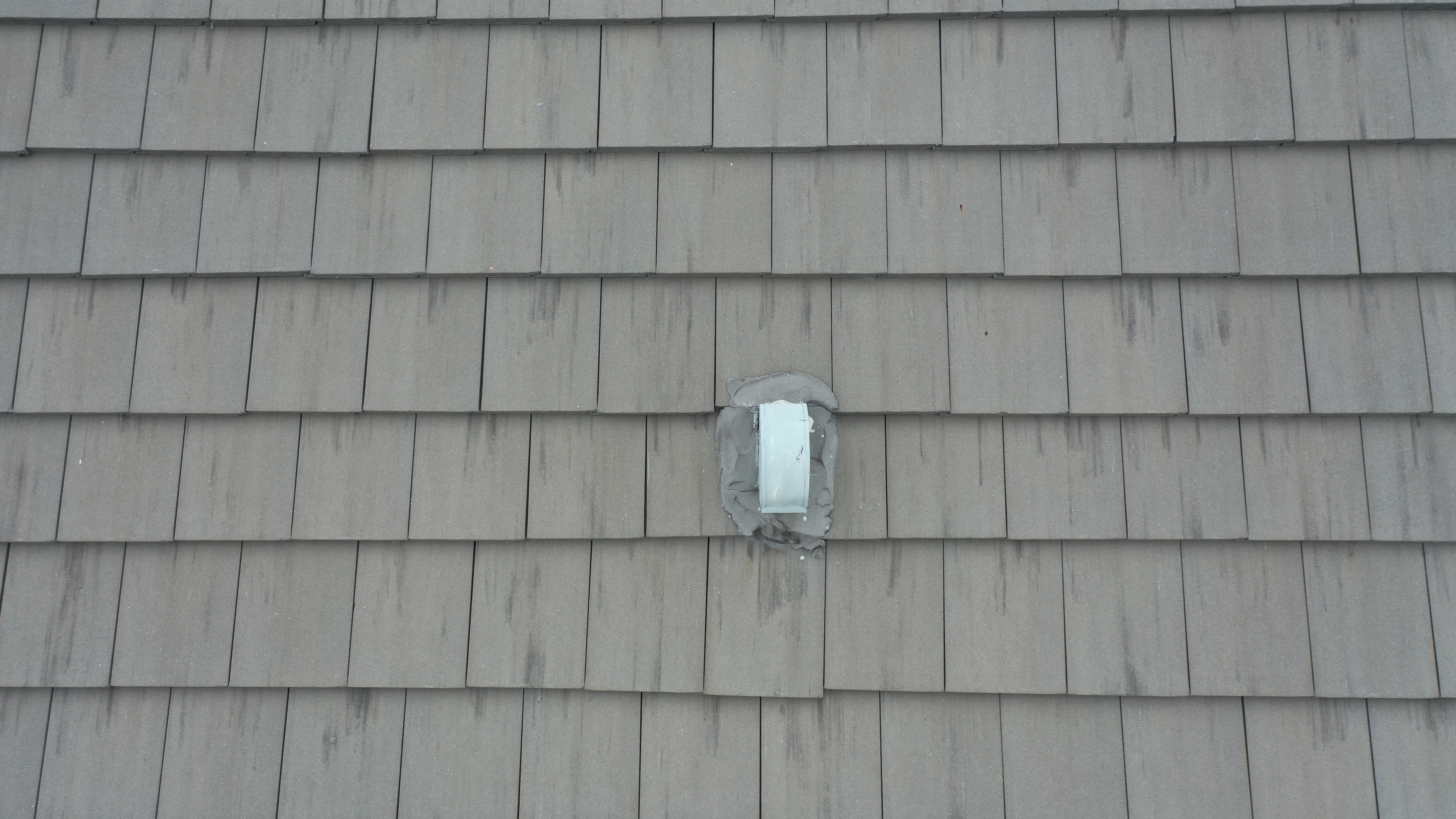
Roof Inspection
Identify issues and maintain the integrity of your roofing systems with our accurate and thorough drone inspections. Our services ensure the safety and longevity of roofs by providing detailed visual and thermal imaging, enabling timely maintenance and repairs.

3D Mapping and Modeling
Achieve precise and detailed 3D models and maps for your projects, utilizing advanced drone technology for superior accuracy. Our 3D mapping and modeling services provide invaluable insights and data for planning, construction, and analysis.

UAV Data Processing
Our skilled GIS team leverages advanced compute servers to masterfully process and map large-scale UAV data. We deliver an extensive array of products tailored to your project's specific requirements, including Orthomosaic Maps, 3D Point Clouds, Digital Terrain Models (DTMs), Digital Surface Models (DSMs), and Contour Maps. Our commitment to precision and customization ensures that you receive the most accurate and relevant data for your analysis and decision-making needs.
Trusted by Clients Worldwide
DTA SOLUTION
Providing exceptional aerial photography, mapping, and inspection services. Our advanced drone technology captures high-quality imagery and data for various industries. Discover how our solutions can elevate your projects to new heights.
0+
More than projects completed each month.
0
Serving active subscribers and clients.
0
Awarded industry recognitions for excellence.


Pricing
Choose the best deal for you
We offer a variety of pricing options tailored to your needs. Whether you need a simple drone inspection, travel-inclusive pricing, or high-quality editing, we have the right package for you.
Compare our services and choose the best deal for your project. Each package includes essential features, with the flexibility to add extra services as needed.
Flat Rate
$150USD
Base Price for Drone Inspection
- Less than 50 miles
- 1 location
- Estimated flight time: 30 min
- Delivery within 24 hours
- High-resolution images
Flat Rate + Travel
$150 + $1.30/mile
Includes Travel Costs
- Includes all Flat Rate services plus:
- Covers more than 50 miles
- Additional cost per mile: $1.30
- Ideal for remote inspections
- Estimated flight time: 30 min - 1 hour
- Delivery in 24-48 hours
- Confirmation of availability required
Editing Services
Starting at $50
Professional Photo & Video Editing
- $50 – Photo Editing (color adjustment, sharpness, optimization)
- $75 – Video Editing (cutting, transitions, quality enhancements)
- $50 – Orthomosaic Map Processing (Processing and assembly of aerial images with precision)
- $100 – RTK Data Processing (Georeferencing and advanced accuracy for specific projects)
Connect with DTA Solution
At DTA Solution, we're ready to take your projects to new heights. With cutting-edge drone technology, we capture stunning imagery for inspections, photogrammetry, and much more. We're here to assist you in achieving new perspectives.
Contact us today
Ready to see your project from a new perspective? Share your goals, and discover how our innovative drone solutions can make them a reality. We're here to support you at every stage.
.png)